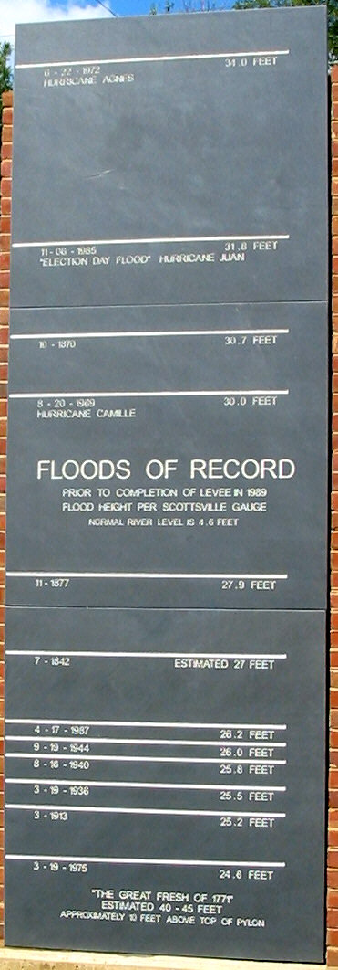
Scottsville Floods of Record
Scottsville's history includes many devasting floods from the James River. The Levee constructed by the U.S. Army Corps of engineers now protects the town.
Floods of Record prior to completion of the Levee in 1989.
Flood Height per USGS Scottsville Gauge.
Normal river height is 4.6 feet.
Hurricane Agnes, 6/22/1972, 34.0 Feet
The slate sign located in Canal Basin Square shows documented flood levels.
Photo by John Bowers
To view construction of the Floods of Record sign, click here.